How to use UP NOAH, a map that shows you how likely you'll be affected by floods
Want to know if your area or somewhere you're going is susceptible to flooding?
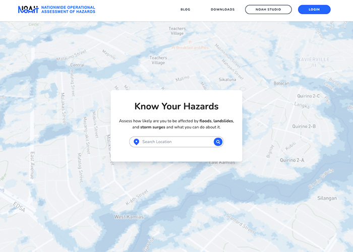
There's actually a website you can go to that shows you how likely a certain place is affected by floods, landslides, and storm surges: the University of the Philippines' Nationwide Operational Assessment of Hazards or NOAH.
NOAH is an online map that shows you hazard levels in any place in the Philippines.
It gained more traction as parts of Luzon were flooded due to rains brought by Typhoon Carina and the southwest monsoon on July 24. Here's how you can check the website and see how floods affect your location.
Using NOAH
First, visit noah.up.edu.ph and you'll be met with a search bar for your location. You can simply key in your location or click on Your Current Location.
Once you click enter, you'll see a 3D map with some parts of it covered with color indicating the flood-prone spots. Yellow stands for low hazard level, orange stands for medium, and red stands for high hazard level.
On the right side of the screen, the website provides details such as hazard levels for flood, landslide, and storm surges.
For instance, keying in Regis Center as a location shows a low flood hazard level.
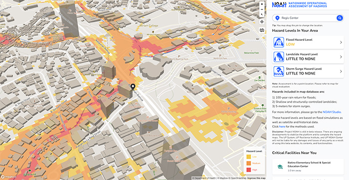
The NOAH website states that the hazards in its map database include 100-year rain return for floods, shallow and structurally controlled landslides, and 5 meters for storm surges.
You can also scroll through the map to see the hazard levels for surrounding areas. This will come in handy when you need to check if the place you're visiting, too, is prone to floods.
Other information such as critical facilities nearby like schools, hospitals, and health centers are shown.
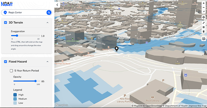
For a more detailed view, click on Noah Studio, which allows you to tweak with different options like 3D terrain, weather satellite image, Internet of Things or IoT, and Exposure Assessment. Some of these features, however, are still in beta.
What is NOAH?
In 2012, the Department of Science and Technology was funding three research projects: ClimateX for better rainfall forecasts, weather sensors development, and the DREAM (Disaster Risk Exposure, Assessment and Mitigation) program for hazard maps. These three were later consolidated under one umbrella, Project NOAH.
Project NOAH was geared to beef up disaster forecasting by the improvement and installation of additional sensor instruments, generation of more detailed hazard maps of the country’s major river basins, and further automation of weather forecasts that will allow expanded lead times.
The program was later shut down by the Duterte administration in 2017 due to a lack of funds. It was later picked up by the University of the Philippines as it launched its Resilience Institute.