Flood of memories
If any new body needs to be constituted, I believe it should be a Department of Memory, since we forget all too easily, and too soon, after the sun shines again.
The country is still reeling from the flooding that the last three typhoons, ending in Ulysses, have brought. It is déjà vu for many who still remember the trauma of Ondoy and Yolanda.
I’ve given over a half-dozen interviews on broadcast media networks, being a go-to resource on the subject of planning and floods. I feel like a broken record answering the same questions of why it floods and what can be done to mitigate flooding. I used to say it’s a matter of same floods, but a different year.
Actually, it’s not the same flood. All floods are different and the context changes from year to year. It’s not just climate change, which is real and which will bring fewer but much stronger typhoons to our shores annually. It is also the fact that our towns and cities are expanding and putting more people in harm’s way. So, the more correct statement would be, “Stronger floods, affecting more people — different year.”
The focus this year was the flooding within the Marikina watershed, as well as the extensive flooding in the Cagayan Valley watershed. Highlighted were the two famous rivers — the Marikina and the Cagayan River — the latter being much longer, but both affecting the same approximate number of people: about a million souls each.
Rivers have flowed throughout most of Philippine history. They are the subjects of illustrations that accompany this week’s article. Before the advent of motor vehicles, most of the Philippine archipelago was connected by water transport, via the inter-island seas or inland through the liquid highways that were our rivers. Many of the Spanish colonial-era churches in Cagayan face the river and not the paved roads (which came much later).
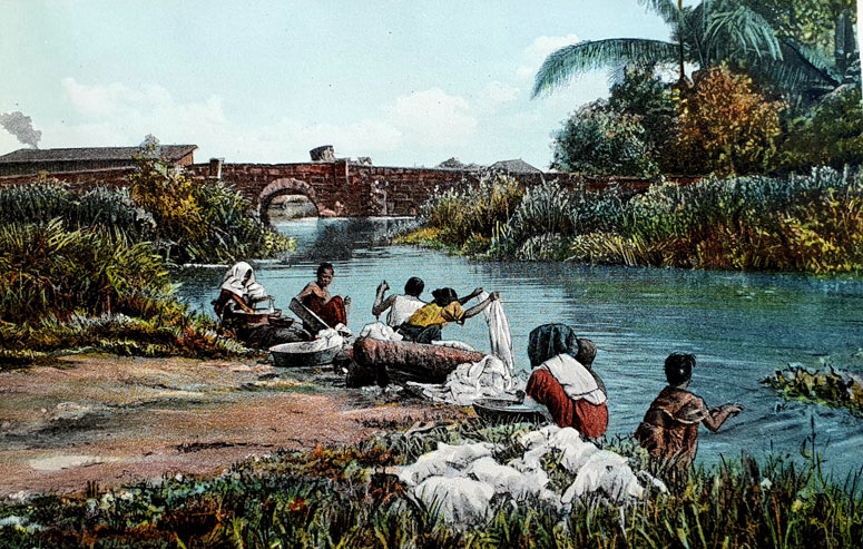
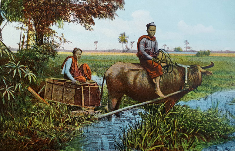
These colorful images of rivers and their uses come from a tourist pamphlet, Picturesque Philippines, which was published over a century ago. The 16 images in the publication are colorized and were based on photographs taken most probably in the first decade of the 20th century.
The rivers and water bodies all look blue and pollution-free. They most probably were back then. One scene depicts laundry being washed along the Pasig, something you would not think of doing today.
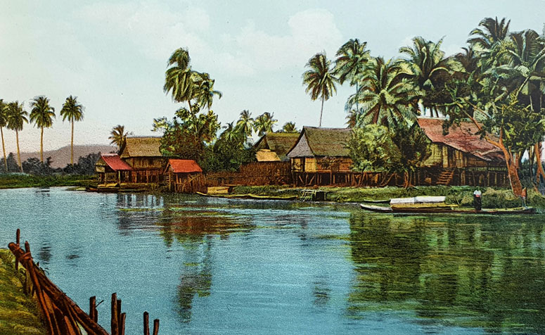
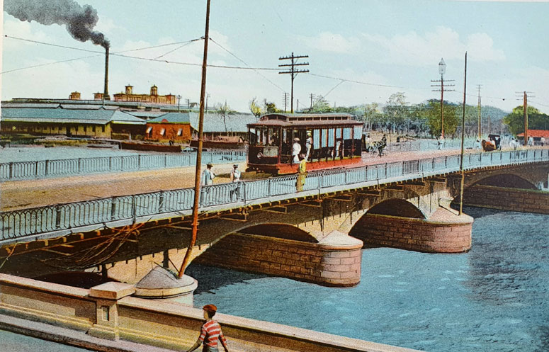
There are a few more images of the Pasig, on which plied numerous vessels like Chinese junks, bancas, tall-mast ships and steamboats that ferried passengers like Dr. Jose Rizal to destinations along the Pasig River and the banks of the Laguna de Bai. One image shows a tranvia (tram) crossing the Pasig on the Puente España (Bridge of Spain), which was damaged in 1910 because of a typhoon.
Yes, the power of water and typhoons were a known commodity even back then. But people knew how to keep out of harm’s way. Since the late 1880s residents would be warned via Father Federico Faura’s innovative barometer that a storm was on its way. Of course, there were far fewer Filipinos that were affected. We were only 15 million nationwide back then. This is the population of just the National Capitol Region (NCR) today.
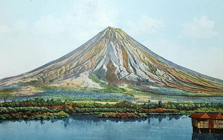
The other images were views of attractions like the Mayon volcano, with the waters of the Gulf of Albay in the foreground. Floodwaters and landslides did not affect too many Bicolanos then, as much of the surrounding region was still forested.
Denuded forests in the uplands and the loss of greenery in watersheds are, of course, the main reason why it floods and why rivers get silted up (leading to more floods). This loss is because of human greed and the lack of enforcement of the very many laws that protect our environment. The term used is “anthropogenic,” or coming from the activities of man. Illegal logging, illegal quarrying and swidden (kaingin) agriculture all combine to compromise the upland’s function of absorbing rain from typhoons.
We have lost over 50 percent of our forest cover in the country in the last century. The Sierra Madre and Cordillera mountains systems are two of the major sources of floodwaters that drained into the Marikina and Cagayan Rivers the other week. The watersheds of both are huge. The Marikina watershed is, in fact, larger than the whole of Metro Manila. The Cagayan Valley watershed is 40 times that of the Marikina Valley watershed.
Many have suggested that a new Department of Water or Department of Disaster be organized. I think that’s a waste of time and will only add to an already bloated bureaucracy. If any new body needs to be constituted, I believe that a Department of Memory is a much better idea, since we forget all too easily, and too soon, after the sun shines again.
This recurring amnesia begets complacency, and this complacency will see us take no action to maintain our rivers and drainage ways, to re-plant our forests, to ban all quarrying, to plan our towns and cities so people are not in the way of rampaging waters.
These images from a hundred years ago are romantic idylls now washed away each year as we make ourselves more and more vulnerable. Being resilient just won’t cut it any more. It’s better I believe, to remember and then take action.
Banner caption: Floods just keep getting worse every year, but we always forget.


